
STILT Footprint Tool
STILT Footprint Tool is an online tool to analyse the potential impact of natural and anthropogenic (human-caused) emissions on the atmospheric carbon dioxide (CO2) and methane (CH4) at any point in Europe. The tool has two parts: The STILT results viewer and the STILT calculation service.
STILT results viewer
The STILT results viewer visualises the footprints calculated using the STILT calculation service, below, with the STILT model. Simulation results of several years for most ICOS stations are available in the STILT viewer, along with other stations included in the European ObsPack and results from arbitrary, user-defined locations within Europe. Please view the STILT results viewer documentation for more information about how to use this tool.
STILT calculation service
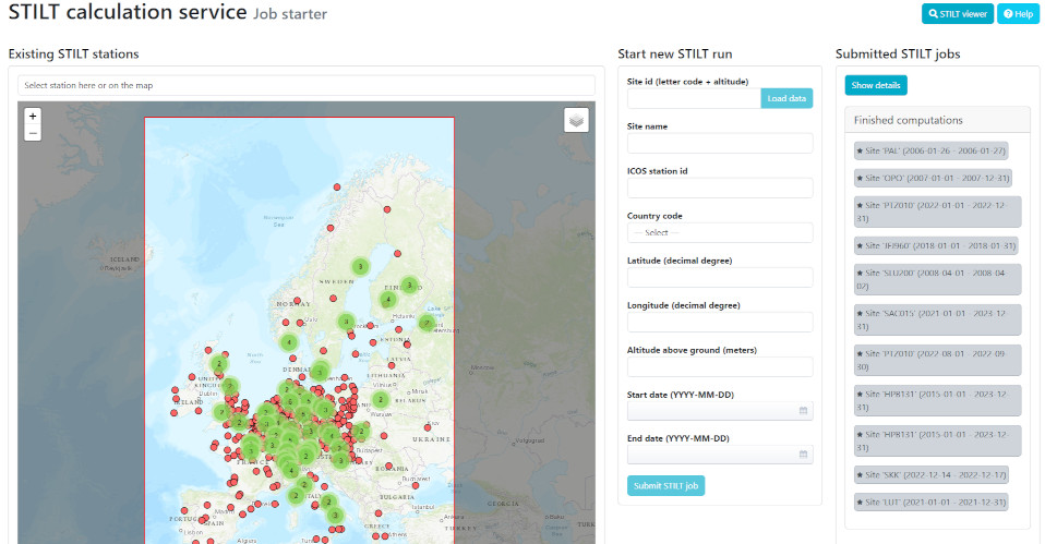
The STILT calculation service can be used for running the simulation tool for any given point within Europe, and for adding the results to the data list available in the STILT results viewer. ICOS stations and stations with observational data included in the European ObsPack are available as pre-defined stations, and one can simulate tracer concentrations for those stations as well. Please view the STILT calculation service documentation for more information about how to use this tool.
Access to the STILT Footprint Tool
For access to the STILT footprint calculation and viewing services, users are automatically redirected to the ATMO-ACCESS login page. Users can log in there using a variety of methods, including ORCID, eduGAIN, and ENVRI community logins.
About STILT Footprint Tool
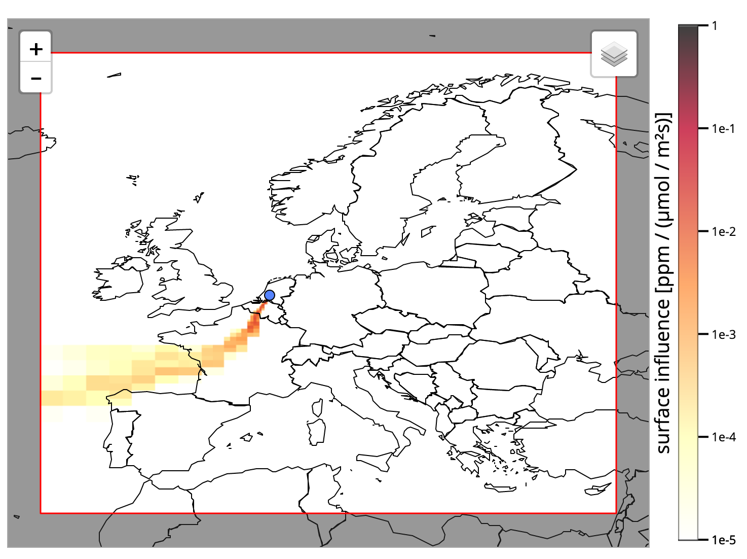
The STILT Footprint Tool is based on model simulations. The tool simulates atmospheric transport and upstream regions influencing the greenhouse gases at the station, creating footprints. These footprints are combined with surface maps of natural and anthropogenic carbon fluxes to trace changes in the concentration of atmospheric carbon dioxide and methane at the station. The STILT Footprint Tool displays both the footprints as well as the concentrations of carbon dioxide or methane at different time points in time-series. This provides a simplified approach that can be used to evaluate different measurement strategies.
The current model framework consists of the Lagrangian transport model STILT (Stochastic Time-Inverted Lagrangian Transport; Lin et al., 2003) together with emission-sector and fuel-type specific emissions from a pre-release of the EDGARv4.3 inventory (EC-JRC/PBL, 2015), biospheric CO2 fluxes from the diagnostic biosphere model VPRM (Vegetation Photosynthesis and Respiration Model; Mahadevan et al., 2008) and CH4 fluxes from wetlands and other natural sources based on model estimations. The model framework has been developed at the Max Planck Institute for Biogeochemistry and is implemented as a web-based service at the ICOS Carbon Portal.
Data from the latest European ObsPack collections, which include all atmospheric CO2 and CH4 data from ICOS stations, are displayed for comparison, allowing users to validate the model and see potential discrepancies.
More detailed information on the STILT model framework and the surface fluxes is also available. For questions, please contact us at footprint (at) icos-cp.eu