Greenhouse gas measuring satellites have excellent spatial coverage – often on a global scale – and high temporal frequency. However, they can struggle with measurement accuracy and precision, as clouds, aerosols and water vapour interfere with measurements thereby reducing accuracy, especially in regions with cloud cover or high humidity.
Additionally, despite frequent observations, there can be gaps in measurements due to the satellite’s repeat cycle.
Moreover, satellite data need to be validated with the help of ground-based measurements. This task is vital to users of remote sensing data.
Work Package 1 of the Horizon Europe project NUBICOS is optimising ICOS tools for satellite calibration and validation to improve the quality of satellite products used in modelling. By addressing data processing from spectrometers installed at sites in Amsterdam Island, Bolivia, France, French Guiana and Morocco, NUBICOS is enhancing satellite data by increasing the measurement density required for satellite calibration and validation.
Validating satellite data from the ground
Greenhouse gas measuring satellites such as GOSAT, OCO-2, OCO-3, TANSAT record “total column” measurements – that is, integrated values from the Earth’s surface all the way to the top of the atmosphere (100 km approx.). These greenhouse gas measuring satellites provide near-real time monitoring of the atmospheric total column concentrations.
While satellites have excellent spatial coverage, they lack temporal coverage. To ensure the accuracy of these, ground-based total column measurements are used as reference points. This is known as calibration and validation – or cal/val – of satellite observations.
Currently, cal/val is carried out using Fourier Transform Infrared Spectrometers (FTS), which use spectral analyses of the direct sunlight to obtain the abundance of greenhouse gas molecules in the atmosphere. High-resolution FTIR Spectrometers make up the Total Carbon Column Observing Network (TCCON) comprised of 30 stations globally. However, these FTIR instruments, while highly accurate, are expensive and rather large instruments, limiting deployment opportunities.
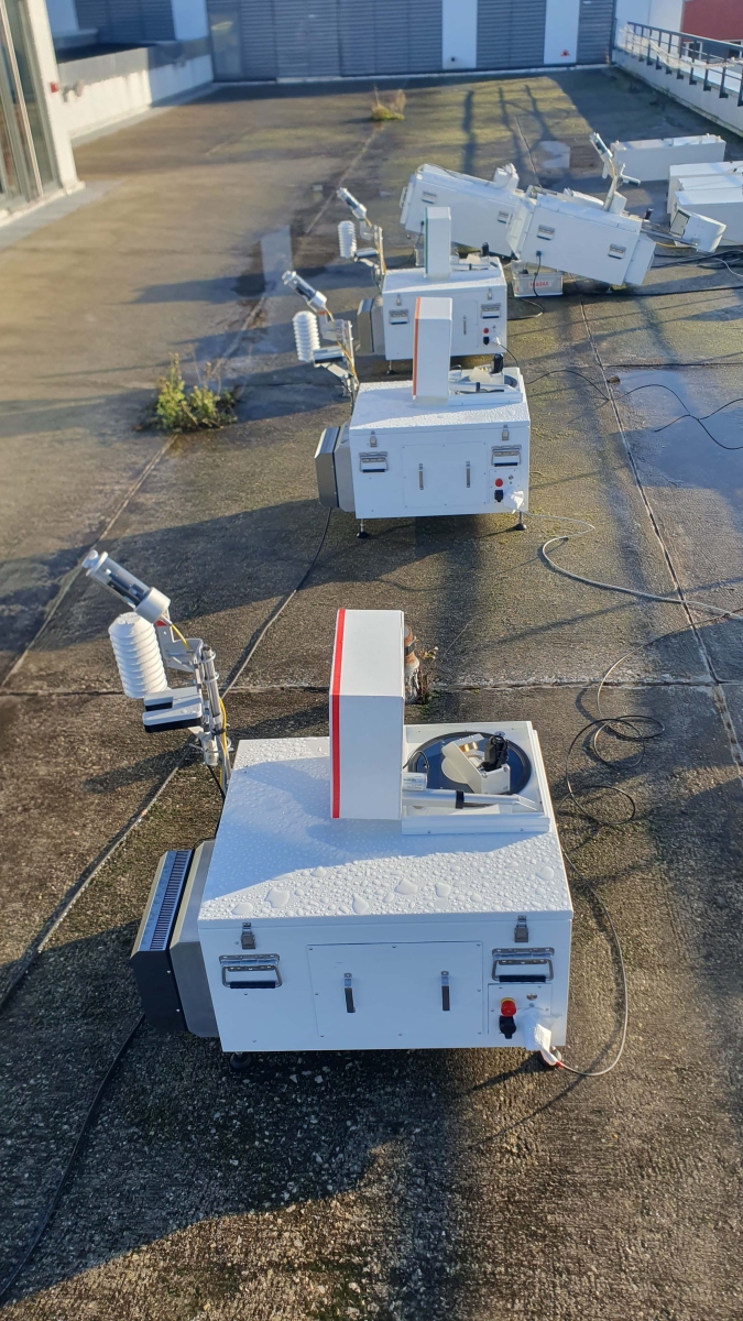
A recent technological development has the potential to vastly expand the network of total column measurement sites, both in terms of the number of stations and in terms of a wider spatial spread. A rugged, portable FTS has been developed by KIT in cooperation with Bruker Optics, and is commercially available from Bruker under the type designation EM27/SUN since 2014 (Gisi et al., 2012, Hase et al., 2016).
The availability of this kind of spectrometer opens up opportunities to further increase measurement density, which is important for satellite validation efforts. In addition, these devices can contribute to the quantification of greenhouse gas sources (Hase et al., 2015, Luther et al., 2019, Tu et al., 2022) have the potential to be used as “standard” instruments to help identify biases between TCCON stations (Mostafavi Pak, Nasrin, et al, 2023, Herkommer et al., 2024).
The lower cost and ease of transport of EM27/SUN instruments presents the opportunity to use them for campaigns in urban areas or harder-to-reach locations in the tropics.
In order to ensure common operation standards and provision of fiducial reference data from EM27/SUN observations, the European Space Agency (ESA) provides continuous support (for example through the FRM4GHG project) for creating and operating COCCON (Collaborative Carbon Column Observing Network). Today, COCCON is a recognized operational supplement of TCCON and its measurements are used for the validation of spaceborne greenhouse gas emissions (Sha et al, 2025). COCCON is the first FTS network requiring rigorous characterisation of each participating spectrometer (Frey et al., 2019, Alberti et al., 2022).
How NUBICOS is improving total column measurements
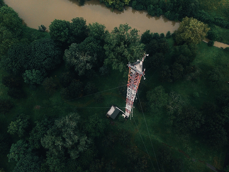
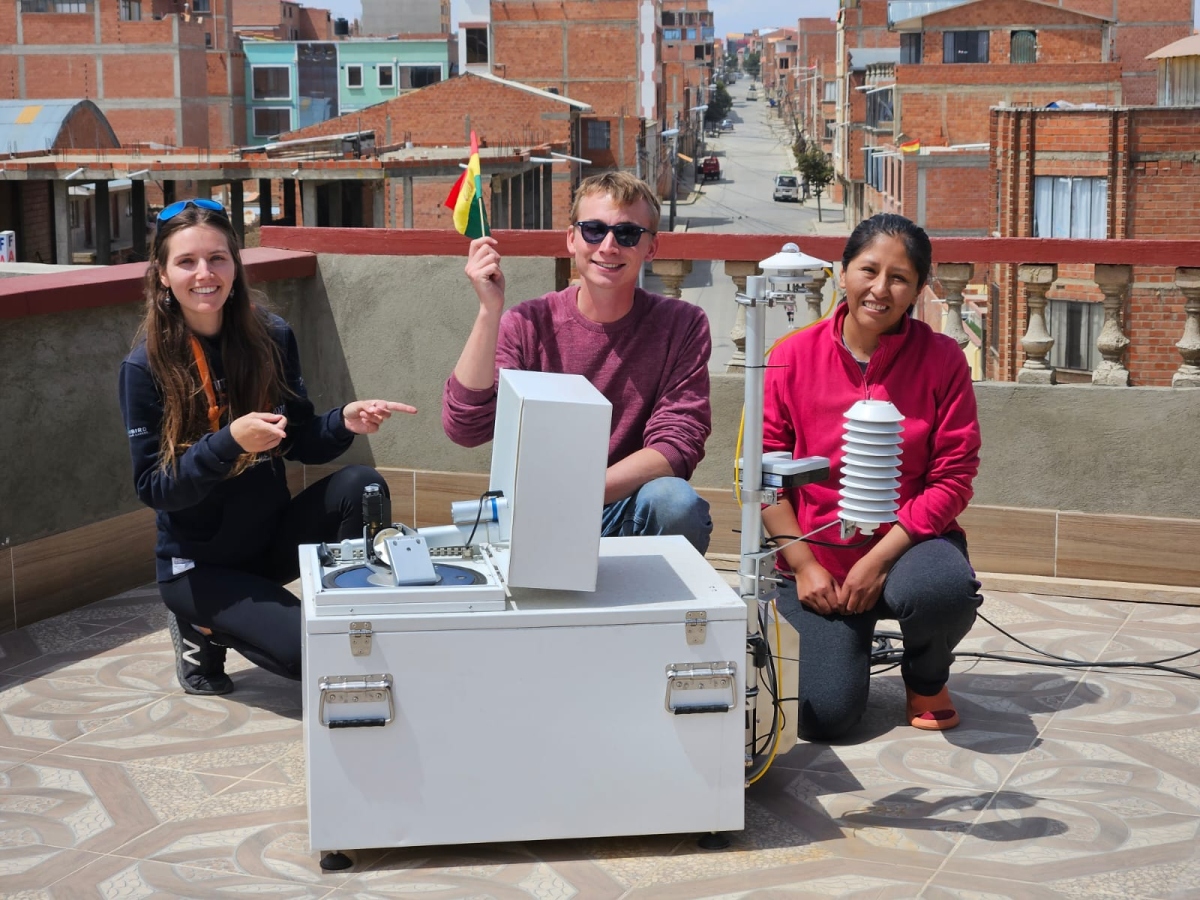
NUBICOS takes advantage of EM27/SUN instruments’ benefits by running trials at a labelled ICOS station, an urban site and several tropical sites. EM27/SUN data is already accessible from sites such as the ICOS Atmosphere station Saclay, a semi-urban Atmosphere station located just outside Paris, and from the Chacaltaya station in Bolivia, a mountain station in the Bolivian Andes which is part of the World Meteorological Organization’s Global Atmosphere Watch (WMO GAW) station network.
“Other sites included in NUBICOS are the remote station on Amsterdam Island, and two more tropical stations in addition to Chacaltaya: ATLAS-MOHAMMED V Atmospheric Research Station in Morocco, and a station in French Guiana that's part of the French network,” says Morgan Lopez, an engineer at LSCE and technical coordinator of the French National Observation Service for greenhouse gas in-situ measurements. “These tropical stations are parts of the French National Observation Service for greenhouse gas in-situ measurements, and they all benefit from sunny conditions which maximise the overlap measurements with satellites.”
Measurements at Amsterdam Island are currently on hold following the severe wildfires on the island. Hopefully, measurements can be resumed this summer.

NUBICOS is not just carrying out a physical instrument deployment. The project is also improving the traceability of EM27/SUN operations and processing of raw spectra using PROFFSAST, the data analysis code required by COCCON. It is provided as open-source technology developed at Karlsruhe Institute of Technology (KIT).
NUBICOS is developing a new layer of data processing allowing full automation, which will lead to faster data provision, making use of the Copernicus Atmosphere Monitoring Service (CAMS) forecast model for the prior, and improves metadata traceability using ICOS tools.
“This work in NUBICOS will provide the tools for traceable, standardised and near-real time monitoring of instruments and data processing for total column measurements in all kinds of environments,” says Michel Ramonet, co-lead of NUBICOS Work Package 1. “The provision of a standardised and near-real time-mode datasets contributes to the operational evaluation of satellite measurements.” These activities complement hardware and software developments as realised by TUM (Dietrich et al. 2021) and by the UK remote sensing community (Kurganski et al., 2025).
These improvements to the data processing layer have the potential to enhance the validation of CAMS services, thereby improving the quality of CAMS greenhouse gas data.
View EM27/SUN data from Amsterdam Island
View EM27/SUN data from ATLAS-MOHAMMED V Atmospheric Research Station, Morocco
View EM27/SUN data from Chacaltaya, Bolivia
View EM27/SUN data from Guyaflux, French Guiana
View EM27/SUN data from Saclay, France